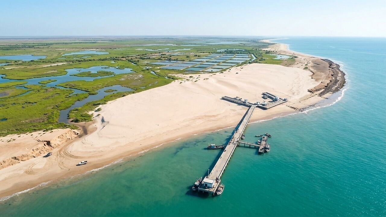
A 400-metre fishing pier constructed on Thailand’s Ban Khlong Wan coastline has triggered significant, unintended environmental shifts, with some areas of the beach advancing by as much as 250 metres. The findings, detailed in a study published in Scientific Reports on August 22, 2025, suggest that coastal transformation is rarely the result of a single structure, but rather an interaction between infrastructure,
Researchers reconstructed the history of the coastline between 1966 and 2023 using historical records, high-resolution LiDAR observations, and sediment analysis. By comparing the pre-development period of 1966–2002 with the post-development era of 2002–2023, the study highlights how the construction of the pier, alongside breakwaters and seawalls, fundamentally altered the local landscape.
Infrastructure and sediment disruption
The most dramatic physical change occurred along the Wa Ko coastline, located south of the pier. The structure acted as a barrier to longshore sediment transport, trapping sand on its updrift side and causing the shoreline to advance by up to 250 metres. This accretion, which covered approximately 40,000 square metres, continued until around 2021, at which point researchers believe the pier reached its maximum sediment-trapping capacity after 13 years of operation.
In contrast, the northern Khlong Wan coastline experienced a different transformation. While the area was predominantly retreating before 2002, nearly 97% of this section showed accretion in the post-development period. However, the study notes that this shift was not solely due to the pier. The Harbour Department had intervened by adding approximately 90,500 cubic metres of sand as an erosion-control measure, meaning the resulting shoreline advance was a combination of structural impact and deliberate human intervention.
Upstream influence on coastal composition
Beyond the immediate impact of coastal engineering, the researchers identified significant changes in the upstream catchment area that influenced the coast. Approximately 3 kilometres inland, a 180-hectare wetland area underwent substantial conversion into aquaculture farms between 1976 and 1995. This process involved vegetation clearance, soil excavation, and dike construction, which altered the flow of fine sediment reaching the Khlong Wan Channel.
Although the Royal Forest Department later reclaimed some of these areas, the study concludes that these upstream land-use changes, combined with the disruption of sand transport by the pier, shifted the coastline from a sandy environment to a muddier one. The researchers emphasize that the Ban Khlong Wan case demonstrates the necessity of integrated coastal management. They argue that future planning must account for the combined effects of infrastructure, sediment dynamics, and upstream land use, rather than focusing on individual structures in isolation. The study also highlights the effectiveness of using high-resolution tools, such as UAV-based LiDAR, to monitor and understand these complex environmental interactions.